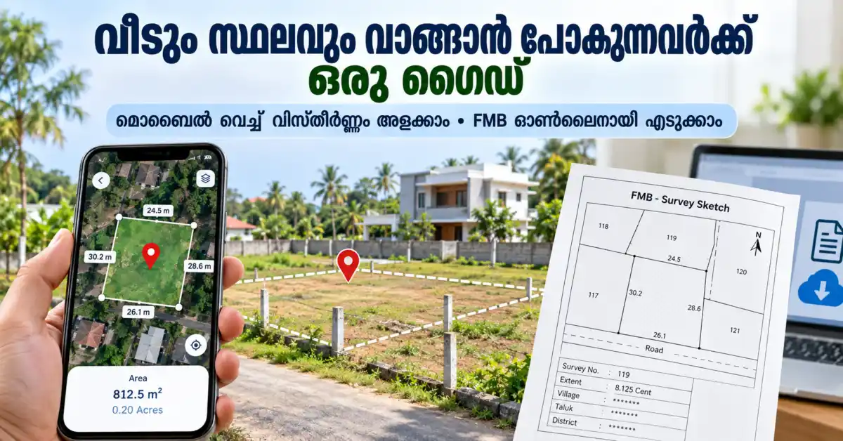
നിങ്ങൾ പുതിയതായി ഒരു സ്ഥലം വാങ്ങാൻ പ്ലാൻ ചെയ്യുന്നുണ്ടോ? അല്ലെങ്കിൽ നിങ്ങളുടെ വീടിനോട് ചേർന്നുള്ള പറമ്പ് എത്ര സെന്റ് ഉണ്ടെന്ന് പെട്ടെന്നൊന്ന് അളന്നു നോക്കണമെന്നുണ്ടോ? മുൻപൊക്കെ ഇതിനായി നമ്മൾ സർവ്വെയർമാരെ വിളിച്ച് ടേപ്പ് പിടിച്ച് അളക്കേണ്ടി വന്നിരുന്നു. എന്നാൽ ഇന്നത്തെ കാലത്ത് നിങ്ങളുടെ കൈവശമുള്ള സ്മാർട്ട്ഫോൺ ഉപയോഗിച്ച് തന്നെ വളരെ എളുപ്പത്തിൽ ഒരു സ്ഥലത്തിന്റെ ഏകദേശ വിസ്തീർണ്ണം (Area) അളക്കാൻ സാധിക്കും.
ഇതുമാത്രമല്ല, ഒരു വസ്തു വാങ്ങുമ്പോൾ ആ സ്ഥലത്തിന്റെ ഔദ്യോഗിക രേഖകളായ എഫ്.എം.ബി സ്കെച്ച് (FMB – Field Measurement Book Sketch) പരിശോധിക്കേണ്ടത് അത്യാവശ്യമാണ്. ഈ രേഖകൾക്കായി ഇനി നിങ്ങൾ വില്ലേജ് ഓഫീസുകളിലോ താലൂക്ക് ഓഫീസുകളിലോ പോയി ക്യൂ നിൽക്കേണ്ടതില്ല. കേരള സർക്കാരിന്റെ പുതിയ ‘Ente Bhoomi) പോർട്ടൽ വഴി ഇതെല്ലാം ഓൺലൈനായി തന്നെ നിങ്ങൾക്ക് എടുക്കാൻ കഴിയും.
സാങ്കേതികവിദ്യ എങ്ങനെ നമ്മുടെ ദൈനംദിന ആവശ്യങ്ങൾക്ക് ഉപയോഗിക്കാമെന്നും, ഫോൺ ഉപയോഗിച്ച് സ്ഥലം അളക്കുന്നതെങ്ങനെയെന്നും, ഔദ്യോഗിക സർവ്വേ രേഖകൾ ഇന്റർനെറ്റ് വഴി എങ്ങനെ സ്വന്തമാക്കാമെന്നും ഈ ആർട്ടിക്കിളിലൂടെ വളരെ ലളിതമായി നമ്മൾ വിശദീകരിക്കുന്നു.
മൊബൈൽ ഉപയോഗിച്ച് എങ്ങനെ സ്ഥലം അളക്കാം?
നിങ്ങളുടെ ഫോണിലെ GPS സിഗ്നലും ഗൂഗിൾ മാപ്പും ഉപയോഗിച്ച് ഭൂമിയുടെ വിസ്തീർണ്ണം അളക്കാൻ സഹായിക്കുന്ന ആപ്പുകളെയാണ് GPS Area Measurement Apps എന്ന് വിളിക്കുന്നത്. ഗൂഗിൾ പ്ലേ സ്റ്റോറിൽ ‘GPS Fields Area Measure‘ പോലുള്ള നിരവധി ആപ്പുകൾ ഇതിനായി ലഭ്യമാണ്.
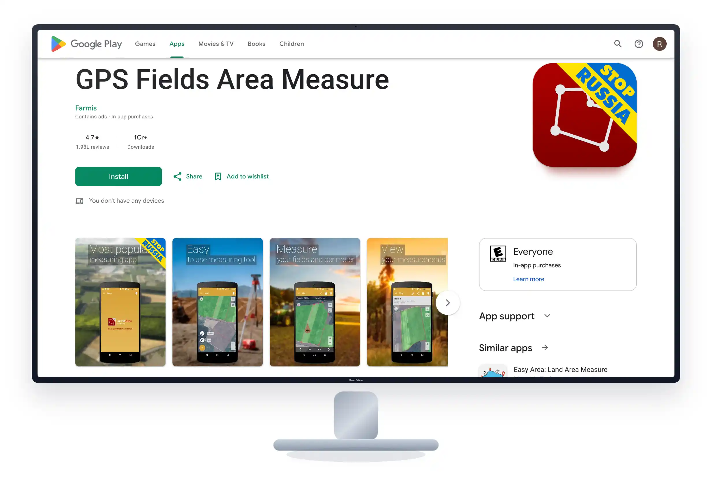
ഈ ആപ്പ് ഉപയോഗിച്ച് എന്തൊക്കെ ചെയ്യാം?
-
ഒരു സ്ഥലത്തിന്റെ ഏകദേശ വിസ്തീർണ്ണം (Area) എത്ര സെന്റ് ഉണ്ടെന്നോ, ഏക്കർ ആണെന്നോ, സ്ക്വയർ മീറ്റർ ആണെന്നോ കണ്ടെത്താം.
-
രണ്ട് സ്ഥലങ്ങൾ തമ്മിലുള്ള ദൂരം (Distance) അളക്കാം.
-
സ്ഥലത്തിന് ചുറ്റും വേലി കെട്ടാൻ അതിർത്തിയുടെ ചുറ്റളവ് (Perimeter) കണക്കാക്കാം.
-
മാപ്പിൽ അതിർത്തികൾ മാർക്ക് ചെയ്തു വെച്ച് പിന്നീട് പരിശോധിക്കാൻ വേണ്ടി സേവ് ചെയ്യാം.
സ്റ്റെപ്പ് ബൈ സ്റ്റെപ്പ് ഗൈഡ്:
-
ആദ്യമായി ആപ്പ് തുറക്കുന്നതിന് മുൻപ് ഫോണിലെ GPS / Location ഓൺ ആക്കുക. കൃത്യത കിട്ടാൻ വീടിന് പുറത്ത് തുറസ്സായ സ്ഥലത്ത് നിൽക്കുന്നതാണ് നല്ലത്.
-
പ്ലേ സ്റ്റോറിൽ നിന്നും ഡൗൺലോഡ് ചെയ്ത ‘GPS Fields Area Measure’ ആപ്പ് തുറന്ന് അതിൽ ‘Area Measurement’ എന്ന ഓപ്ഷൻ തിരഞ്ഞെടുക്കുക.
-
നിങ്ങളുടെ നിലവിലെ ലൊക്കേഷൻ ആപ്പ് തനിയെ കാണിക്കും. അല്ലെങ്കിൽ നിങ്ങൾ അളക്കാൻ ഉദ്ദേശിക്കുന്ന സ്ഥലം മാപ്പ് സൂം ചെയ്ത് കണ്ടുപിടിക്കുക.
-
മാപ്പിൽ കാണുന്ന നിങ്ങളുടെ സ്ഥലത്തിന്റെ നാല് മൂലകളിലും (Corners) വിരൽ വെച്ച് ടാപ്പ് ചെയ്ത് ഓരോ പോയിന്റുകൾ മാർക്ക് ചെയ്യുക. സ്ഥലം ഒരു പ്രത്യേക ഷേപ്പിൽ അല്ല കിടക്കുന്നതെങ്കിൽ അതിർത്തി വളയുന്ന ഭാഗങ്ങളിലെല്ലാം പോയിന്റുകൾ കൊടുക്കുക.
-
എല്ലാ പോയിന്റുകളും മാർക്ക് ചെയ്തു കഴിയുമ്പോൾ, ആപ്പ് ആ സ്ഥലത്തിന്റെ വിസ്തീർണ്ണം സ്ക്രീനിൽ കാണിക്കും. ഇത് സ്ക്വയർ ഫീറ്റിലോ സ്ക്വയർ മീറ്ററിലോ ആയിരിക്കും കാണിക്കുക. ആപ്പിലെ സെറ്റിംഗ്സ് മാറ്റിയാൽ ഇത് നേരിട്ട് സെന്റിലേക്കോ (Cent) ഏക്കറിലേക്കോ (Acre) മാറ്റാനും സാധിക്കും.
GPS മെഷർമെന്റ് 100% കൃത്യമാണോ?
ഒരിക്കലുമില്ല. മൊബൈൽ ആപ്പ് ഉപയോഗിച്ച് അളക്കുന്നത് ഒരു Approximate measurement മാത്രമായി കാണുക. ഫോണിന്റെ ജി.പി.എസ് ക്വാളിറ്റി, മരങ്ങൾ, വലിയ ബിൽഡിംഗുകൾ, കാലാവസ്ഥ എന്നിവയെല്ലാം ഈ അളവിനെ ബാധിച്ചേക്കാം.
അതുകൊണ്ട് ഒരു സ്ഥലം കാണാൻ പോകുമ്പോൾ അവർ പറയുന്ന വിസ്തീർണ്ണം ഏകദേശം ശരിയാണോ എന്ന് പരിശോധിക്കാനോ, കൃഷിസ്ഥലത്തിന്റെ വിസ്തീർണ്ണം അറിയാനോ മാത്രമേ ഇത് ഉപയോഗിക്കാവൂ. അതിർത്തി തർക്കങ്ങൾ പരിഹരിക്കാനോ, സ്ഥലം രജിസ്റ്റർ ചെയ്യാനോ, വീട് വെക്കാൻ പെർമിറ്റ് എടുക്കാനോ ഈ മൊബൈൽ ആപ്പ് അളവ് ഉപയോഗിക്കാൻ കഴിയില്ല. അത്തരം നിയമപരമായ കാര്യങ്ങൾക്ക് എപ്പോഴും ഒരു അംഗീകൃത സർവ്വെയറെ വെച്ച് തന്നെ അളക്കേണ്ടതുണ്ട്.
എന്താണ് എഫ്.എം.ബി സ്കെച്ച് ? ഇത് ഓൺലൈനിൽ കിട്ടുമോ?
നിങ്ങളുടെ വസ്തുവിന്റെ കൃത്യമായ അളവുകളും, അതിർത്തികളും, അയൽപക്കത്തെ സർവ്വേ നമ്പറുകളും ഒക്കെ രേഖപ്പെടുത്തിയിട്ടുള്ള ഔദ്യോഗിക രേഖയാണ് ഫീൽഡ് മെഷർമെന്റ് ബുക്ക് സ്കെച്ച് അഥവാ FMB സ്കെച്ച്. ഒരു വസ്തു വാങ്ങുമ്പോഴോ വിൽക്കുമ്പോഴോ ഇത് വളരെ പ്രധാനപ്പെട്ട ഒരു രേഖയാണ്.
മുൻകാലങ്ങളിൽ ഇത് വില്ലേജ് ഓഫീസുകളിൽ പോയി അപേക്ഷ നൽകി എടുക്കേണ്ടിയിരുന്നു. എന്നാൽ ഇപ്പോൾ കേരള സർവേ ആൻഡ് ലാൻഡ് റെക്കോർഡ്സ് ഡിപ്പാർട്ട്മെന്റ് മിക്ക രേഖകളും ഡിജിറ്റൈസ് ചെയ്ത് ഓൺലൈനായി ലഭ്യമാക്കിയിട്ടുണ്ട്. ‘എന്റെ ഭൂമി’ (Ente Bhoomi) എന്ന പുതിയ സംയോജിത സിറ്റിസൺ പോർട്ടൽ വഴിയാണ് ഇത് ജനങ്ങൾക്ക് നൽകുന്നത്.
FMB സ്കെച്ച് ഓൺലൈനായി ഡൗൺലോഡ് ചെയ്യുന്ന വിധം
ഓൺലൈനായി രേഖകൾ എടുക്കുന്നതിന് മുൻപ് നിങ്ങളുടെ സ്ഥലത്തിന്റെ ജില്ല, താലൂക്ക്, വില്ലേജ്, ബ്ലോക്ക് നമ്പർ, സർവ്വേ അല്ലെങ്കിൽ റീ-സർവ്വേ നമ്പർ (Survey / Re-survey Number), സബ് ഡിവിഷൻ നമ്പർ എന്നിവ കൃത്യമായി അറിഞ്ഞിരിക്കണം. ആധാരത്തിലോ കരം അടച്ച രസീതിലോ ഈ വിവരങ്ങൾ ഉണ്ടാകും.
- പോർട്ടൽ തുറക്കുക: കേരള സർക്കാരിന്റെ ഔദ്യോഗിക വെബ്സൈറ്റായ
entebhoomi.kerala.gov.inതുറക്കുക.
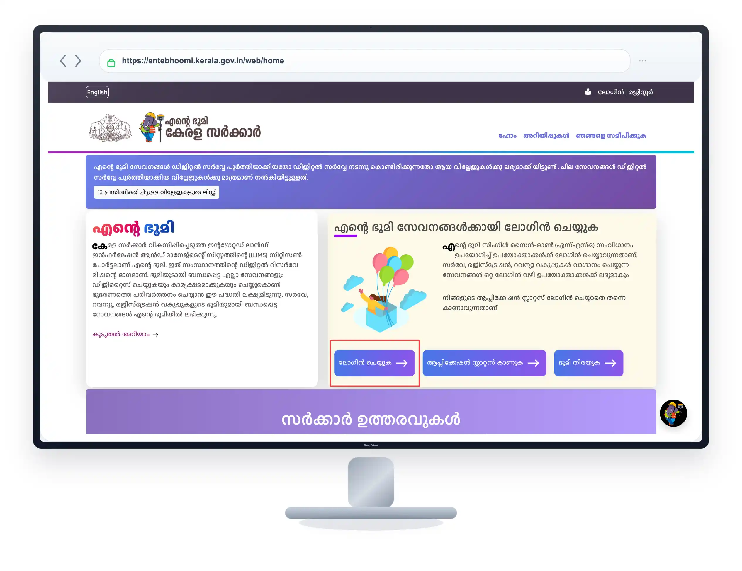
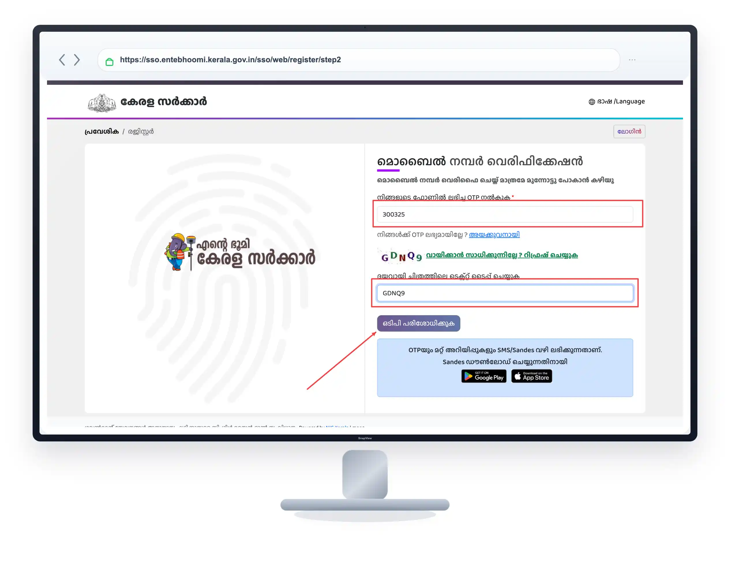
ലോഗിൻ ചെയ്യുക: നിങ്ങളുടെ മൊബൈൽ നമ്പർ ഉപയോഗിച്ച് ഒടിപി (OTP) നൽകി സിസ്റ്റത്തിൽ ലോഗിൻ ചെയ്യുക.
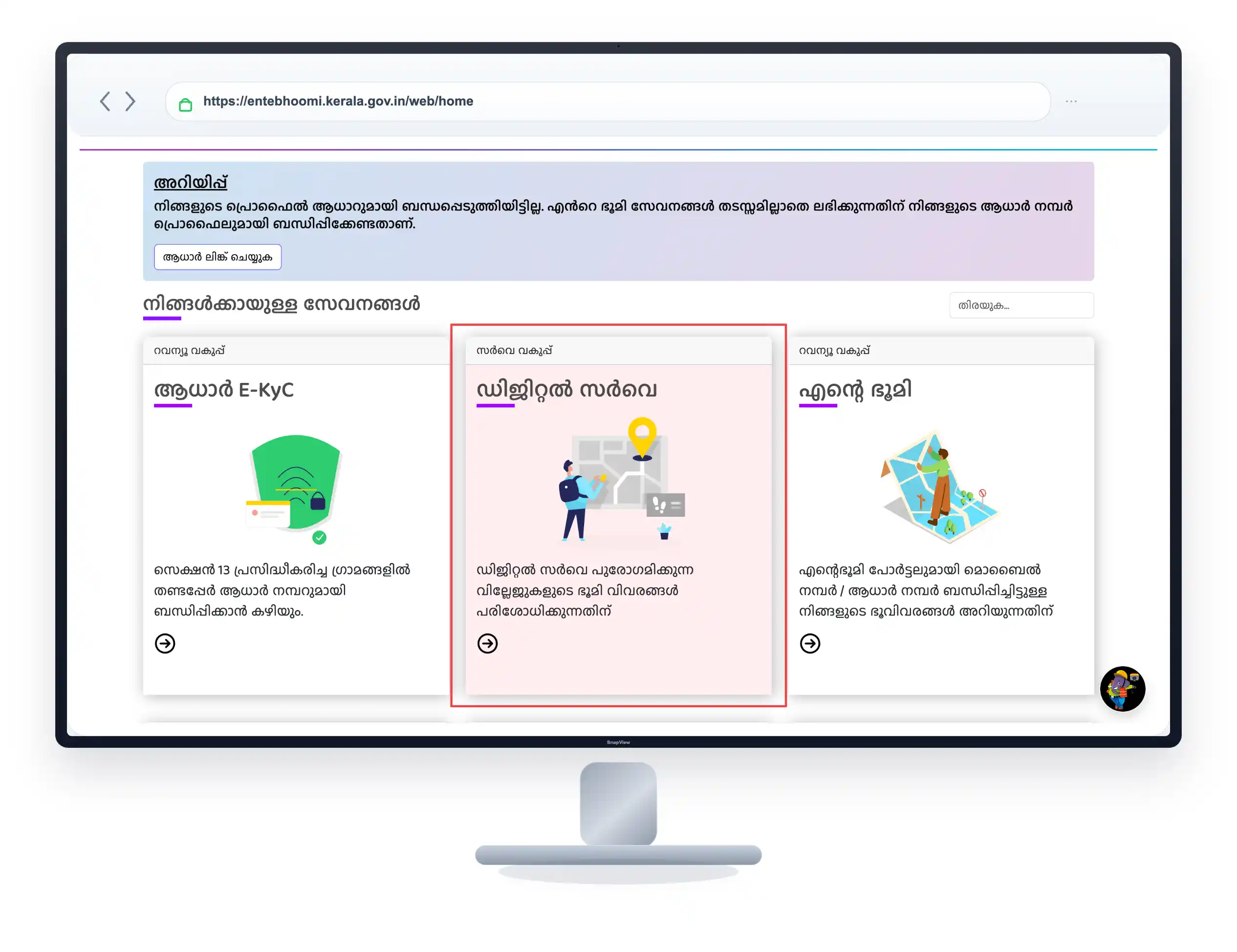
സർവീസ് തിരഞ്ഞെടുക്കുക: ഹോം പേജിലെ മെനുവിൽ നിന്നും സർവ്വേ സേവനങ്ങൾ (Survey-related services) എടുക്കുക. അതിൽ “ഡോക്യുമെന്റ് വാങ്ങുന്നതിന്” (Purchase Document) എന്നൊരു ഓപ്ഷൻ കാണാം, അതിൽ ക്ലിക്ക് ചെയ്യുക.
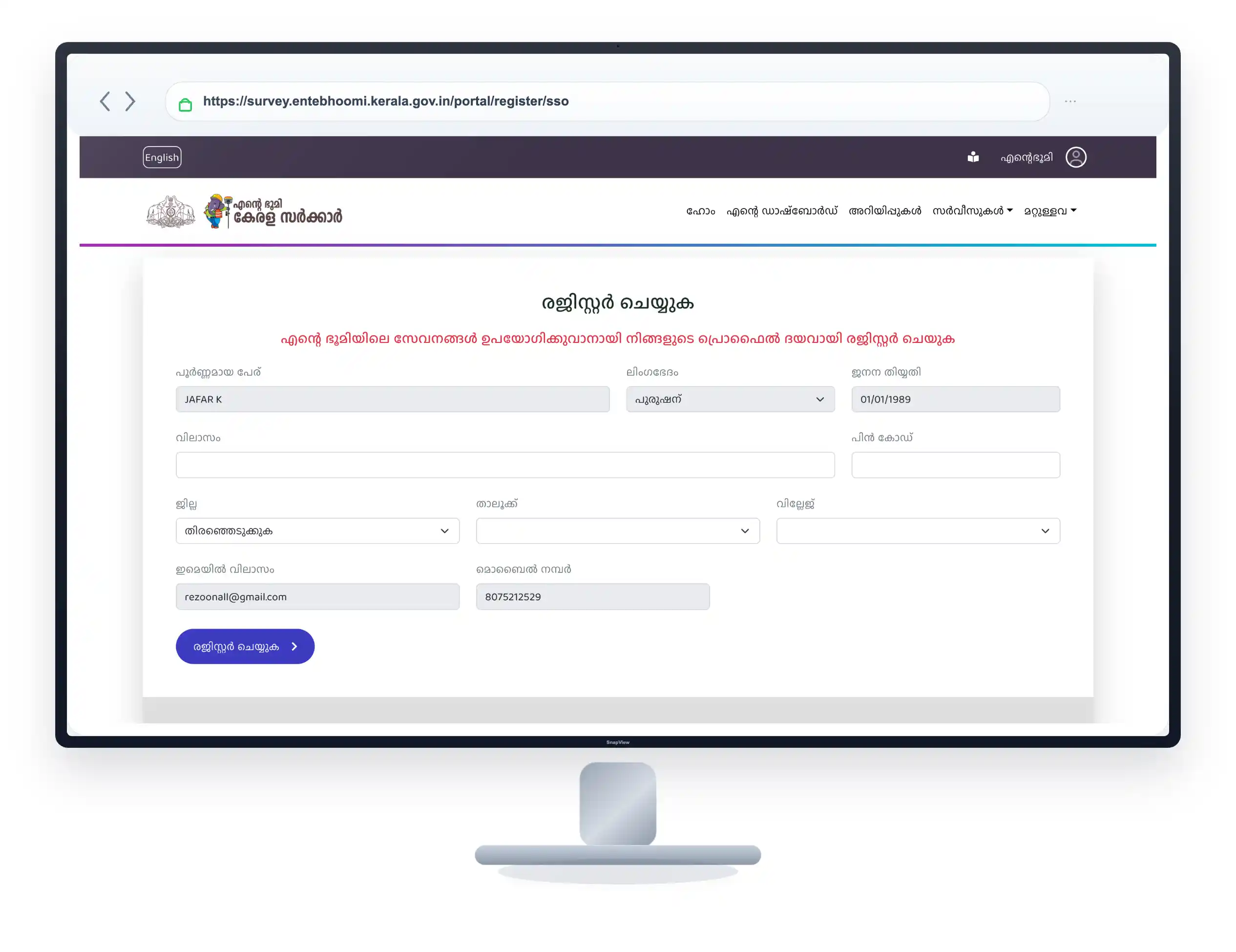
വിവരങ്ങൾ നൽകുക: നിങ്ങളുടെ സ്ഥലത്തിന്റെ ജില്ല, താലൂക്ക്, വില്ലേജ്, സർവ്വേ നമ്പർ, സബ് ഡിവിഷൻ നമ്പർ എന്നീ കാര്യങ്ങൾ തെറ്റാതെ ടൈപ്പ് ചെയ്തു കൊടുക്കുക.
രേഖ പരിശോധിക്കുക: വിവരങ്ങൾ നൽകിയാൽ ആ സർവ്വേ നമ്പറിലുള്ള ലഭ്യമായ രേഖകളുടെ ലിസ്റ്റ് താഴെ വരും. അതിൽ നിന്നും നിങ്ങൾക്ക് വേണ്ട FMB സ്കെച്ച് സെലക്ട് ചെയ്യുക.
ഫീസ് അടച്ച് ഡൗൺലോഡ് ചെയ്യുക: സർക്കാർ നിശ്ചയിച്ചിട്ടുള്ള ഫീസ് (ഉണ്ടെങ്കിൽ) ഓൺലൈനായി അടച്ച ശേഷം സ്കെച്ച് നിങ്ങളുടെ ഫോണിലേക്കോ കമ്പ്യൂട്ടറിലേക്കോ PDF ആയി ഡൗൺലോഡ് ചെയ്യാം.
ഒഴിവാക്കേണ്ട അബദ്ധങ്ങൾ
-
തെറ്റായ സർവ്വേ നമ്പർ നൽകൽ: സ്കെച്ച് എടുക്കുമ്പോൾ സബ് ഡിവിഷൻ നമ്പർ തെറ്റിയാൽ അയൽവാസിയുടെ സ്ഥലത്തിന്റെ സ്കെച്ച് ആയിരിക്കും നിങ്ങൾക്ക് ലഭിക്കുക. ആധാരം നോക്കി കൃത്യമായി ടൈപ്പ് ചെയ്യുക.
-
വ്യാജ വെബ്സൈറ്റുകൾ ഉപയോഗിക്കുന്നത്: സ്കെച്ച് എടുക്കാനായി ഗൂഗിളിൽ സെർച്ച് ചെയ്യുമ്പോൾ കാണുന്ന പ്രൈവറ്റ് ഏജൻസികളുടെ സൈറ്റുകളിൽ കയറി പണം നഷ്ടപ്പെടുത്തരുത്. ഔദ്യോഗിക ‘എന്റെ ഭൂമി’ പോർട്ടൽ മാത്രം ഉപയോഗിക്കുക.
-
ആപ്പ് അളവുകൾ അന്തിമമായി കാണുന്നത്: മൊബൈൽ ആപ്പിലെ അളവ് വെച്ച് അതിർത്തി തർക്കങ്ങൾ ഉണ്ടാക്കാൻ ശ്രമിക്കുന്നത് അബദ്ധമാണ്. അത് പൂർണ്ണമായും ഔദ്യോഗികമല്ല.
-
രേഖകൾ കാണുന്നില്ലെങ്കിൽ പരിഭ്രമിക്കുന്നത്: നിങ്ങൾ സെർച്ച് ചെയ്തിട്ട് നിങ്ങളുടെ സ്ഥലത്തിന്റെ സ്കെച്ച് ഓൺലൈനിൽ കാണിക്കുന്നില്ലെങ്കിൽ അത് വില്ലേജിൽ ഇല്ല എന്നല്ല അർത്ഥം. ആ വില്ലേജിലെ രേഖകൾ ഡിജിറ്റൈസ് ചെയ്യുന്ന പ്രക്രിയ പൂർത്തിയായിട്ടുണ്ടാകില്ല. ഇത്തരം സാഹചര്യത്തിൽ വില്ലേജ് ഓഫീസുമായി ബന്ധപ്പെടുക.
Pro Tips
-
കണക്കുകൾ എളുപ്പമാക്കാൻ: നിങ്ങളുടെ സ്കെച്ചിൽ അളവുകൾ ‘ഹെക്ടറിലോ’ ആർസിലോ (Ares) ആയിരിക്കും. 1 ആർ (Are) എന്നാൽ ഏകദേശം 2.47 സെന്റ് ആണെന്ന് ഓർത്തു വെച്ചാൽ കണക്കുകൂട്ടാൻ എളുപ്പമായിരിക്കും.
-
ആപ്പ് ഉപയോഗിക്കുമ്പോൾ: നടന്നു അളക്കുന്നതിനേക്കാൾ മാപ്പിൽ കൃത്യമായി പിൻ (Pin) ചെയ്ത് അളക്കുന്നതാണ് ഫോണിൽ കൂടുതൽ കൃത്യത നൽകുക.
മൊബൈൽ ആപ്പും FMB സ്കെച്ചും: പെട്ടെന്നൊരു താരതമ്യം
| ഫീച്ചർ | GPS Area Measurement App | FMB Survey Sketch |
| ഉപയോഗം | സ്ഥലത്തിന്റെ ഏകദേശ അളവ് പെട്ടെന്ന് മനസ്സിലാക്കാൻ | അതിർത്തികളും സർവ്വേ നമ്പറുകളും പരിശോധിക്കാൻ |
| കൃത്യത (Accuracy) | ഏകദേശം മാത്രം (ഫോണിന്റെ ജി.പി.എസ് അനുസരിച്ച് മാറും) | 100% കൃത്യവും ഔദ്യോഗികവും |
| നിയമ സാധുത | കോടതിയിലോ രജിസ്ട്രേഷനോ ഉപയോഗിക്കാൻ കഴിയില്ല | പൂർണ്ണമായ നിയമ സാധുതയുണ്ട് |
| ലഭ്യത | പ്ലേ സ്റ്റോറിൽ നിന്നും ഫ്രീ ആയി ഡൗൺലോഡ് ചെയ്യാം | സർക്കാരിന്റെ ഔദ്യോഗിക പോർട്ടലിൽ ഫീസ് നൽകി എടുക്കണം |
Frequently Asked Questions
1. മൊബൈൽ ഉപയോഗിച്ച് അളന്നാൽ സ്ഥലത്തിന്റെ സെന്റ് കൃത്യമായി കിട്ടുമോ?
കൃത്യമായി കിട്ടില്ല. മൊബൈൽ ആപ്പുകൾ ജി.പി.എസ് വെച്ചാണ് അളക്കുന്നത്. അതുകൊണ്ട് ലഭിക്കുന്ന സെന്റോ ഏക്കറോ ഒരു ഏകദേശ കണക്കായി (Approximate) മാത്രമേ കാണാൻ പാടുള്ളൂ.
2. ഗൂഗിൾ മാപ്പ് വെച്ച് ഒരു സ്ഥലം അളക്കാൻ കഴിയുമോ?
തീർച്ചയായും. നിങ്ങളുടെ ഫോണിലെ സാധാരണ ഗൂഗിൾ മാപ്പ് തുറന്ന്, നിങ്ങൾ നിൽക്കുന്ന സ്ഥലത്ത് ടാപ്പ് ചെയ്ത് ‘Measure Distance’ എന്ന ഓപ്ഷൻ വഴി രണ്ട് പോയിന്റുകൾ തമ്മിലുള്ള ദൂരവും ഏകദേശ വിസ്തീർണ്ണവും കണ്ടെത്താൻ കഴിയും.
3. എന്റെ സ്ഥലത്തിന്റെ എഫ്.എം.ബി (FMB) ഓൺലൈനിൽ കാണുന്നില്ല, എന്തുകൊണ്ടാണ്?
കേരളത്തിലെ എല്ലാ വില്ലേജുകളിലെയും രേഖകൾ ഇതുവരെ പൂർണ്ണമായും ഡിജിറ്റൈസ് ചെയ്തു കഴിഞ്ഞിട്ടില്ല. ഡിജിറ്റൽ സർവ്വേ പൂർത്തിയായ വില്ലേജുകളിലെ രേഖകൾ മാത്രമേ പോർട്ടലിൽ ലഭ്യമാകൂ. ഓൺലൈനിൽ ലഭ്യമല്ലെങ്കിൽ നിങ്ങൾ വില്ലേജ് ഓഫീസിൽ നേരിട്ട് അപേക്ഷ നൽകണം.
4. എഫ്.എം.ബി സ്കെച്ച് എടുക്കാൻ സർവ്വേ നമ്പർ നിർബന്ധമാണോ?
അതെ. ജില്ല, താലൂക്ക്, വില്ലേജ് എന്നിവയ്ക്ക് പുറമെ നിങ്ങളുടെ വസ്തുവിന്റെ സർവ്വേ നമ്പർ (അല്ലെങ്കിൽ റീ-സർവ്വേ നമ്പർ) കൊടുത്താൽ മാത്രമേ സിസ്റ്റത്തിൽ നിന്നും നിങ്ങളുടെ സ്ഥലത്തിന്റെ സ്കെച്ച് കണ്ടെത്താൻ കഴിയുകയുള്ളൂ.
(നിരാകരണം: ഈ ആർട്ടിക്കിൾ പൊതുവായ വിവരങ്ങൾ നൽകാൻ വേണ്ടി മാത്രം തയ്യാറാക്കിയിട്ടുള്ളതാണ്. മൊബൈൽ ആപ്പുകൾ നൽകുന്ന അളവുകൾ ഔദ്യോഗിക സർവ്വേക്ക് പകരമാകില്ല. സർക്കാർ പോർട്ടലുകളിലെ സേവനങ്ങളിലും ഫീസുകളിലും ഭാവിയിൽ മാറ്റങ്ങൾ വന്നേക്കാം.)